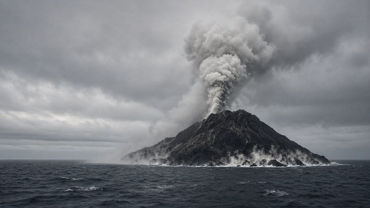
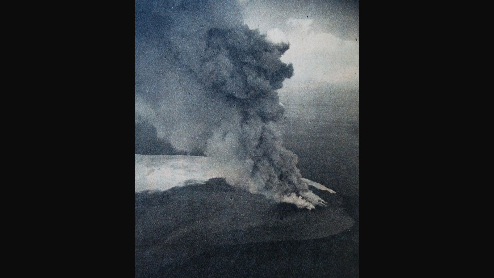
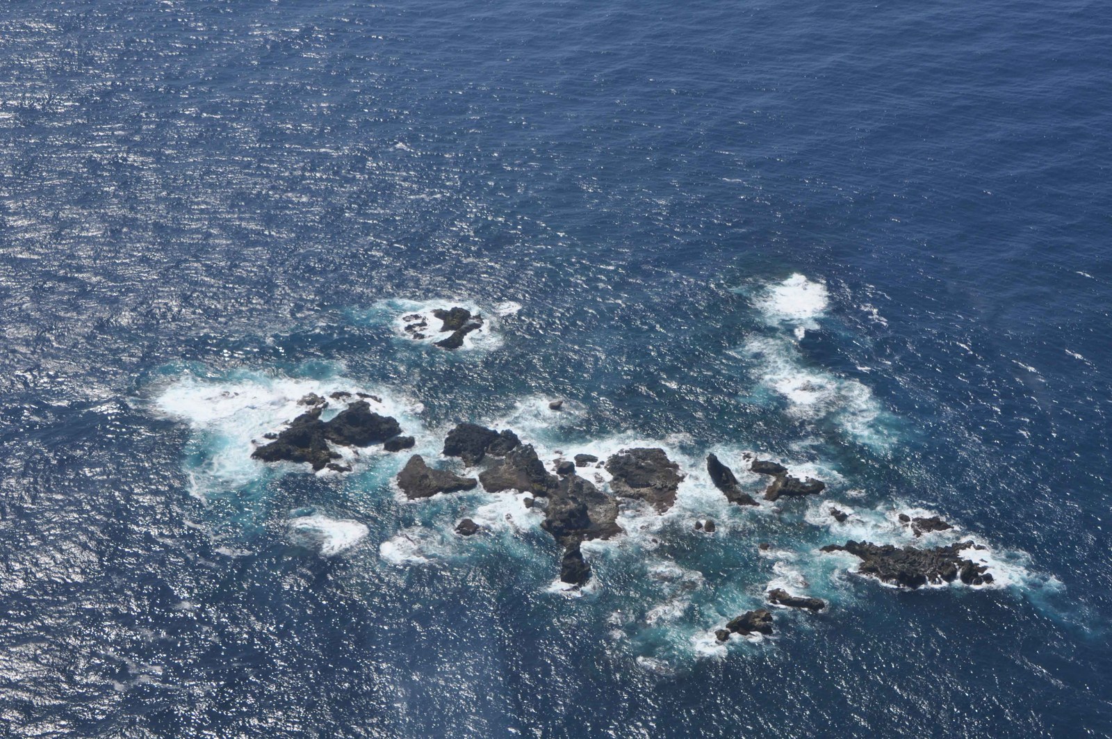
Some believe a stretch of the Pacific south of Tokyo is the Bermuda Triangle's twin. Adherents call it the Devil's Sea or the Dragon's Triangle, and they place it around Miyake-jima and the Izu island chain toward the Bonin Islands. Its emblem case is a Japanese government survey ship, sent in 1952 to study a volcano rising out of that sea, that sailed out and was never heard from again.
The Pacific twin
CNN's 2011 survey of sea legends sets out the frame. The Devil's Sea lies roughly around the island of Miyake, about 100 kilometers south of Tokyo, and ancient legends of dragons living off the Japanese coast gave the region its other name. According to CNN, author Charles Berlitz wrote that Japan lost five military vessels, along with 100 scientists studying the region, in just two years between 1952 and 1954. Those figures reach us through CNN's summary of his work.
The region also appears in a 1972 article by naturalist Ivan Sanderson, "The 12 Devil's Graveyards Around the World." Sanderson's "Vile Vortices," as they became known, sit at matching latitudes north and south of the equator and are said to be hotspots for unexplained phenomena. He proposed that hot and cold currents crossing at these points might create electromagnetic disturbances that upset instruments and vessels.
https://www.cnn.com/2011/TRAVEL/05/31/sea.legends.bermuda.triangle/index.html
A ship sent to find a new volcano
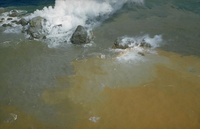
Japanese hydrographers, writing in Hydro International, tell how the voyage began. On September 17, 1952, a fishing boat reported a submarine eruption east of the Bayonnaise Rocks, and the new shoal was named Myojin-sho after the boat that found it. The Chief Hydrographer dispatched Survey Vessel No. 5 Kaiyo Maru to fix its position precisely, with 22 crew and nine scientists aboard.
One of them was Ryoichi Mita, a 26-year-old geographer in the Hydrographic Department's chart division. He had studied this nameless shallow years earlier, concluded it was the top of a volcanic cone, and published a warning to mariners in Hydrographic Bulletin No. 12 in June 1949. The ship left Tokyo on the morning of September 23. At 8:30 that evening a routine telegram came in. After that, the vessel was completely silent. When the search went out on September 25, all it found were fragments. Decades later, the Hydrographic Department built an unmanned survey boat, Manbou, to work in volcanic waters too dangerous for a crew.
https://www.hydro-international.com/article/submarine-volcanoes-and-autonomous-survey-vehicles
No crew, no hull, no oil
The Japan Association of Marine Safety's detailed account, in Japanese, fills in the ship and the search. Kaiyo Maru No. 5 was completed in 1943 at Mitsubishi's Hikoshima yard as a Navy survey vessel: 211 gross tons, 34 meters, one 400-horsepower diesel, a top speed of 11.4 knots. She carried no radar and no gyrocompass. It records her last report at 20:00 on September 23.
Searchers found fragments and a lifebuoy bearing the ship's name. The committee record notes that neither crew, nor hull, nor even floating oil was ever found, though the search ran into October. Then there is the detail believers cite most. Among the five reasons the 1952 investigation report gives for the ship ending up over the crater is that volcanic activity probably caused geomagnetic change, so she may have reached a position her crew never intended. The magnetic factor, in other words, is in the official file.
https://www.nikkaibo.or.jp/pdf/606_2025-1.pdf
Watching from the day before
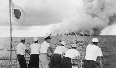
A contemporary 1952 paper in Zisin, the journal of the Seismological Society of Japan, comes from a scientist who watched the reef erupt from a training ship, the Shin'yo Maru of Tokyo Fisheries University, on September 23, the day before the loss. He saw five explosions. Its English summary describes the missing vessel as a "211-ton oceanographical survey boat of the Maritime Safety Board" with 31 people aboard.
For adherents, the paper shows how close everyone was to the edge that week. One ship stood off and watched. The next day, the survey ship working the same reef was gone.
https://doi.org/10.4294/zisin1948.5.4_157
Heard from 8,600 kilometers away
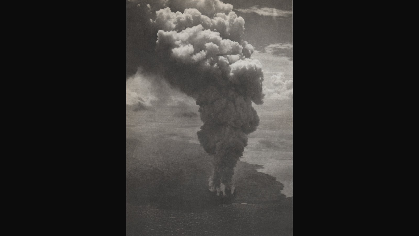
The moment of the loss was fixed from the other side of the Pacific. A paper in the Journal of the Oceanographical Society of Japan describes U.S. Navy SOFAR hydrophone stations at Point Sur and Point Arena, California, about 8,600 kilometers away, that logged more than 100 explosions from Myojin. From those records, researchers fixed the ship's destruction at about 12:20 Japan time on September 24, 1952.
Nobody aboard sent a signal at that moment. The only witnesses were microphones under the sea on another continent.
https://www.jstage.jst.go.jp/article/kaiyou1942/9/2/9_2_53/_article/-char/en
The island that came and went
The Japan Meteorological Agency's eruption record for the Bayonnaise Rocks lists the 1952 to 1953 Myojin-sho eruption and the loss of the survey ship with 31 dead. It also records the strangest part of the story: the new island appeared, vanished the day before the loss, reappeared in October and vanished again.
The official account comes from the Maritime Safety Agency's investigation committee, which adopted its conclusion on December 22, 1952. It found that at about 12:20 on September 24 a submarine volcanic explosion struck the ship from below on the starboard side, destroying most of her starboard superstructure, and that she capsized and sank at once. The timing was fixed by a 0.9 meter tsunami recorded at Hachijo-jima and by the U.S. Navy hydrophones. A volcano that comes and goes, a compass that may have been pulled off true, and a ship that left no oil on the water. Was it one eruption on one bad day, or is the Devil's Sea something more?
https://www.data.jma.go.jp/vois/data/tokyo/323_BeyonesuRocks/323_history.html